wawxのTwitterイラスト検索結果。 18 件


By Saturday morning this is about 2.8 trillion gallons of water falling, just on Washington state #wawx


Beautiful Valley Sunrise -
With that little bit of fog in the valley this morning looking east towards Kulshan (Mt.Baker) 🏔 and the Twin Sisters.. what a phenomenal sunrise 🌄 #wawx

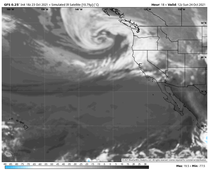
Trans-Pacific moisture is headed toward British Columbia Canada and the U.S. states of Washington and Oregon this weekend. #GOESWest water vapor is tracking the impressive flow as it feeds into a Low pressure storm system. Updates at https://t.co/0L306T3BBa #BCstorm #WAwx #ORwx


He can spring into this trap 😏.. /j
#FNAF #springtrap #LOL #fivenightsatfreddys #cowx #wawx #yourmom


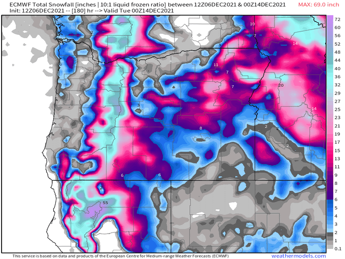
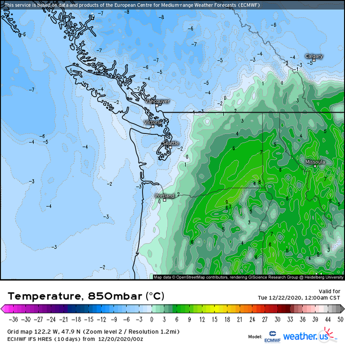
First graphic is the 12z Eps run from Dec 12th, 5 day ensemble mean centered around Christmas. And here is this morning’s 12z Euro run for the late in the day on Christmas. Some differences, but overall the models did a good job sniffing this out this pattern far in advance #wawx


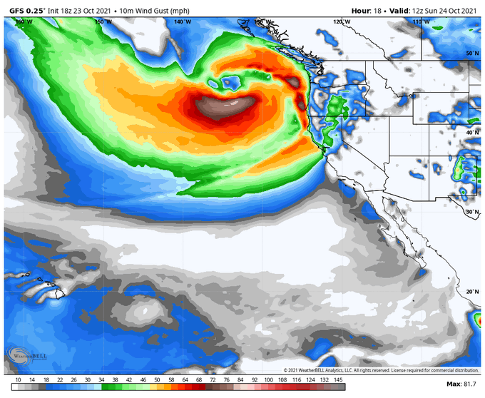
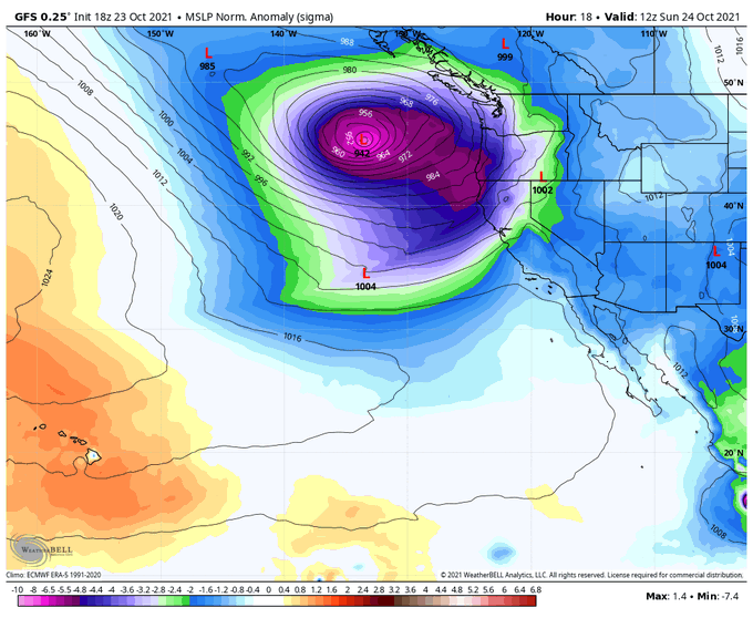


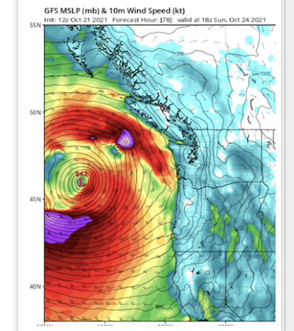
most powerful storm in Northwest history, with the lowest central pressure ever observed. this storm is no joke keep checking the weather for our area! #wawx #windstorm #bombcyclone


#wawx Its a week out, but I love seeing the Olympic Velocity shear zone (Puget Sound Tornado Alley?) showing up in the models.


Available moisture looks to approach 200% of normal this weekend as an atmospheric river impacts the Pacific Northwest. Steadiest rain Saturday night through Sunday. Humid on Sunday, too #wawx #orwx #atmosphericriver #bcstorm


#wawx The similarities of the 1974 heavy snow event and tomorrows system is really uncanny. This frontal passage tomorrow is starting to look like a powerful event. Some truly intense precipitation rates showing.


Forecast shows the smoke pouring in from the east. Wildfires exploded in Eastern Washington through today dumping a lot of smoke there, and now the big east wind storm we've been talking about is blowing it all this way: #wawx
MORE: https://t.co/aK2fEaXd4n