bcstormのTwitterイラスト検索結果。 25 件


Here we go again! Winter driving on the West Coast explained. #BCStorm

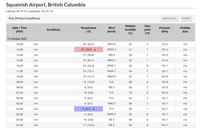

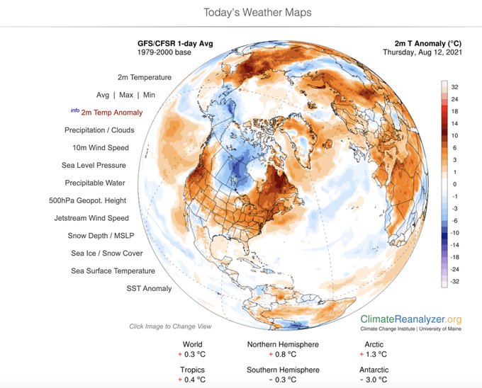
🌡️Exceptional high temperatures for mid-October in #BritishColumbia! 🥵
29.1°C Squamish
28.5°C Abbotsford
28.3°C Hope
28.2°C Agassiz
27.6°C Port Alberni
27.5°C Pitt Meadows
27.4°C Cultus Lake
25.8°C Port Mellon
25.6°C North Cowichan
25.4°C Callaghan Valley [884 m]
#BCstorm 1/2


As the upper low over the coast & upper low over Alberta shift away from BC, the widespread rain & high elevation snow in the Interior from the AB low will gradually fizzle out through the AM-early aft as a weak ridge builds & the AB SFC + upper low move further east. #BCStorm

Trans-Pacific moisture is headed toward British Columbia Canada and the U.S. states of Washington and Oregon this weekend. #GOESWest water vapor is tracking the impressive flow as it feeds into a Low pressure storm system. Updates at https://t.co/0L306T3BBa #BCstorm #WAwx #ORwx


Mar d'Hivern. 💎 Winter Sea. #Mar #Mediterrani #Barcelona #Catalunya 📸 Collage de Fotos d'Àngels @kakelones #StormHour #ThePhotoHour #Photography #BCStorm #photooftheday #Waves #NatureBeauty


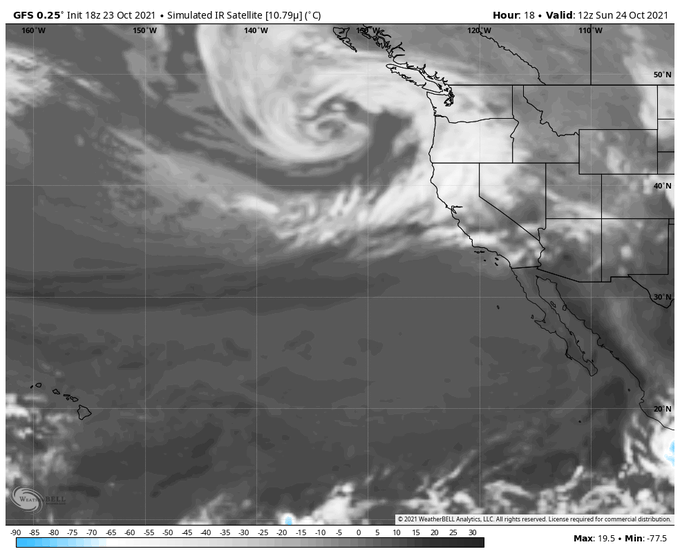


River of rain directed at southwest BC, as seen in these images from GOES-17 taken around 7 PM PDT tonight. Originating well north of the Hawaiian Islands, this should probably not be characterized as a pineapple express.
#BCstorm
@bc_news_addict
@ChuckDalldorf
@susanmark3000


Another historic day in #BritishColumbia 🇨🇦 with up to 40.2°C in #Squamish and 39.8°C in Port Alberni (new August record for the entire #VancouverIsland).
Monthly record in #Abbotsford (39.4°C), #Nanaimo (37.0°C), Pitt Meadows (36.6°C), #Victoria (35.5°C), etc.
#BCstorm #heatwave


Available moisture looks to approach 200% of normal this weekend as an atmospheric river impacts the Pacific Northwest. Steadiest rain Saturday night through Sunday. Humid on Sunday, too #wawx #orwx #atmosphericriver #bcstorm


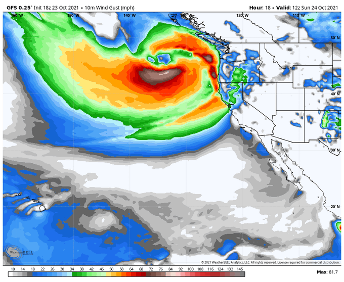
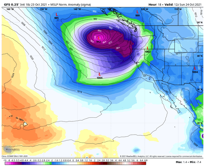
Check out that cyclonic formation over BC. Four lovely images from METEOR M N2 produced around 9:30 AM PST here in #Vancouver with my WSat2 station.
#BCstorm
@bc_news_addict
@KMacTWN
@Cole_Beast
@WestSeaWx
@RandySmall
@Zach_wx
@OrcaBC101
@MMadryga
@MorganKIRO7

The next 2-3 weeks could easily give way to 2-3 metres of snow in the coastal range with a + EPO. Storm track set to become hyperactive at times...❄️#BCsnow #BCstorm