Mapire wraps up a week of digital resources, combining incredible georeferenced surveys of with overlaid on digital elevation data. looking north from 2nd military survey of Habsburg Empire (Franziszeische Landesaufnahme, 1806-1869) https://t.co/2A0d6lN4fc

15 31

Do you produce MAPS 🗺️ in your research??

SCALE and COORDINATES are a MUST in maps!!
(and cross-sections)

No exceptions! This is key to REUSE them!
(saving us all much-needed time & giving you citations)

And please be kind 🙏 & share your maps georeferenced 🗾👏

4 43

This week I have been mostly constructing a digital map of an arboretum and georeferencing 20-30yr old paper maps of the planted treescape.

4 19

New database of 7100+ georeferenced occurrence records of sea the Southern Ocean https://t.co/MCSeKx0B4i

11 10

Exciting new version of Georeferencer v4 launched. https://t.co/U26XniM2fv
https://t.co/XXObMVGyh3

58 77

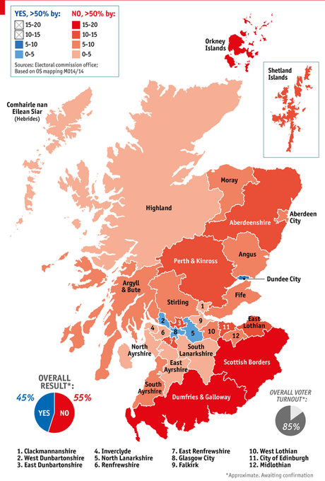
"How Scotland voted" w/ and without areas resized - via and http://t.co/nZQATaJFgk

2 0