
Mark Richardsonさんのイラストまとめ
@slavetothehatFollow @slavetothehatさんをフォローする
フォロー数:613 フォロワー数:1738


The HS looks only marginally ok around the main islands but that area has so many damn points. And I started this process to save time and I'm realizing it's going to probably take more than I want to fix this. So rather than tug of war this I'm going to go back to the Contours.


Honestly though my most played game is a misnomer as I almost always GM. That said its also era based.
I played this game the most when I was
1 - In High School
2 - In University
3 - My 30s
4 - My 40s


1 - First RPG you played
2 - Last RPG you played
3 - RPG you played most often
4 - RPG you recommend https://t.co/DheCEFKMxo


Lots of new followers after @mforbeck call for Cartographers who lean modern.
Greetings, 20+ years of real world mapping and I use Geomatics tools to do my RPG maps. Current project is 7 maps for @BiohazardJeff Blue Planet 2e, three maps in Development look like this
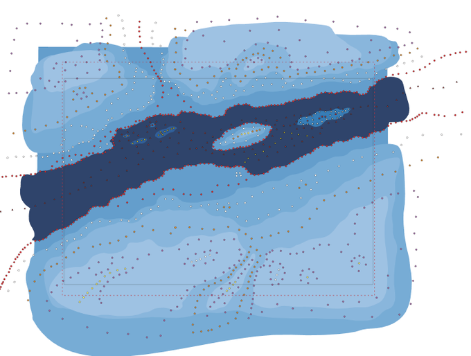
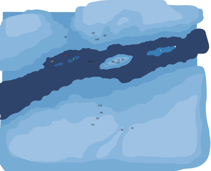
Really unsure how this will come out, the depth changes over distance are EXTREME ie -110m to a -6 KM in ~150m of distance. Well I've drawn a point distribution of the plateaus and and the lower trenches.
Once more into the Deep of @BiohazardJeff Blue Planet, today we're starting with building up the Digital Elevation points for Down-Home to sketch out the watery trench.

Ok well I've done a bunch of work on on my prep for this about 4 hours altogether. Only got some lines on the board now but we will chip at this over the week.
Some quick contours to give me some guide posts.
I want to have a number of slim pillars rising from the Trench.

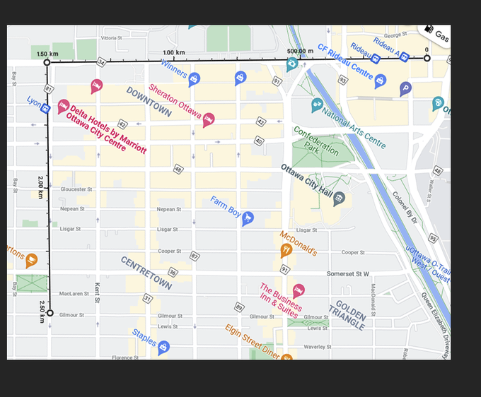
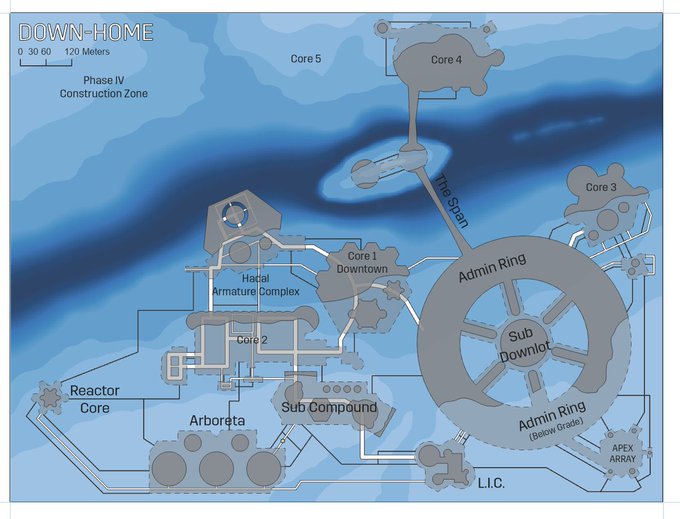
So now to sketch this Down-Home Station for @BiohazardJeff Blue Planet. I know the entire settlement is only 1.5 x 1 km, it's very tiny with only 3,300 people. First step I measure this out in my home town Ottawa to just get a sense for size. This isn't going to be big...

Today's Blue Planet Progress, ~7 hours.
Obviously a fair bit of progress, the terrain is much closer to what I'm aiming for at this point.


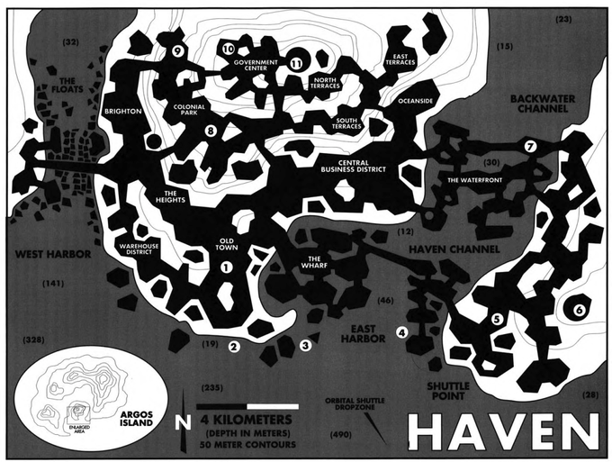
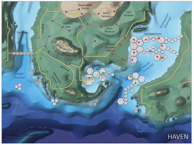
Back into Blue Planet mapping, today I'm going to build the Transportation constraints for the City of Haven, that is use Major/Minor Roads and Tram lines to box in the city layout. Luckily I have a 90s map for ideas by @BiohazardJeff but it's just guidance.
Where I'm at / 90s