dataScientistのTwitterイラスト検索結果。 54 件中 2ページ目
@Deadfellaz Welcome to the #horde !!, #NYC based #DataScientist, #digitalasset #investor #
Mapping the world's flight paths.
This map shows flight paths in 2022 and was derived from ADS-B data.
Made with #Python using #matplotlib and #Numpy. #DataScience #DataVisualization #Map #shipping #Geography #dataviz #data #DataScientist
[#Map] of Pangea 🌎 with modern-day borders
#banking #fintech #insurtech #finserv #marketing #payments #ESG #100DaysOfCode #datascientist #RStats #flutter #JavaScript #TensorFlow #Python @enricomolinari #CyberSecurity #AI #IoT #blockchain #GovTech #OpenPA #smartcities #ESG #SDGs
Topography map of France. Colours correspond to the of the national flag. #TopographyTuesday
This map was made with #Python using #Numpy, #matplotlib and #Pandas. #data #DataScience #data #dataviz #DataScientist #eu #geography #artwork #art #France #Map
Topography map of Kenya. Colours correspond to the of the national flag. #TopographyThursday
This map was made with #Python using #Numpy, #matplotlib and #Pandas. #data #DataScience #data #dataviz #DataScientist #eu #geography #artwork #art #Kenya #Africa #Map
Top 10 #Algorithms books Every Programmer Should Read. #BigData #Analytics #DataScience #AI #MachineLearning #IoT #IIoT #Python #RStats #TensorFlow #JavaScript #ReactJS #CloudComputing #Serverless #DataScientist #Linux #Programming #Coding #100DaysofCode
https://t.co/52KCIVVoGw
What does the world really look like? As we all know the earth is flat so here is the map of the world that we should be teaching in schools. Day 28 of the #30DayMapChallenge - #Python #Numpy, #matplotlib #. #data #DataScience #data #DataScientist #icewall #FlatEarth #sheep
3D digital elevation model of Taiwan for day 19 of the #30DayMapChallenge - Islands.
This map was made with #Python using #Numpy, #matplotlib and #earthpy. #data #DataScience #data #dataviz #DataScientist #geography #artwork #art
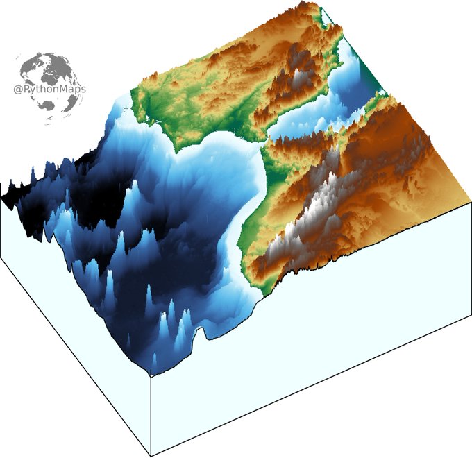
3D digital elevation model of the strait of Gibraltar for day 11 of the #30DayMapChallenge .
This map was made with #Python using #Numpy, #matplotlib and #earthpy. #data #DataScience #data #dataviz #DataScientist #eu #geography #artwork #art #Gibraltar #Brexit
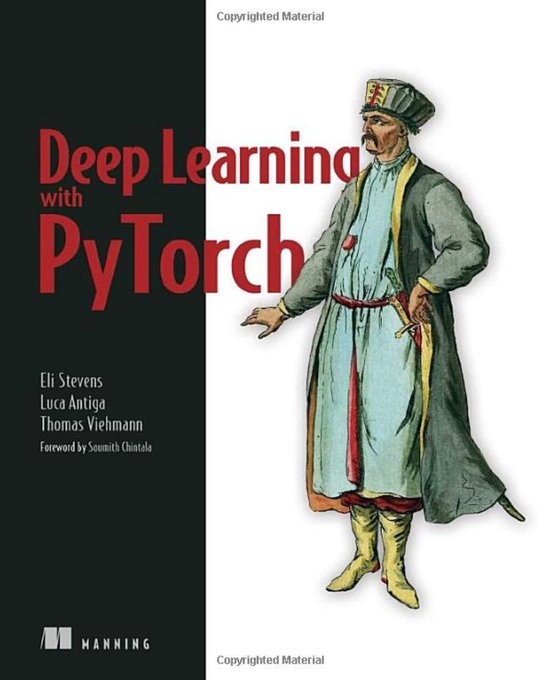
Top #DeepLearning #Books for 2021
https://t.co/1gEpvq90xN
v/ @gp_pulipaka
#DataScience #BigData #Analytics #AI #MachineLearning #ML #IoT #IIoT #IoTPL #CloudComputing #CyberSecurity #Serverless #RPA #NLP #Coding #Programming #100DaysofCode #CodeNewbie #DataScientist #DEVCommunity https://t.co/qax73Dt1eh
#DataScientists 🆚 #MachineLearning #Engineers 👨🏽💻
https://t.co/0pg1Xd9vbO
v/ @gp_pulipaka
#DataScience #BigData #Analytics #AI #ML #IoT #IIoT #IoTPL #Python #RStats #CloudComputing #Serverless #RPA #NLP #Coding #Programming #100DaysofCode #CodeNewbie #DEVCommunity #WomenWhoCode https://t.co/o8Yw3gyxEy
Topography map of the greatest country in the world... Ireland. Colours correspond to the national flag obviously.
This map was made with #Python using #Numpy, #matplotlib and #Pandas. #data #DataScience #data #dataviz #DataScientist #Ireland #eu #geography #artwork #art
Contour line map showing the topography of Great Britain. Zoom in!
This map was made with #Python using #Numpy, #matplotlib and #earthpy. #data #DataScience #data #dataviz #DataScientist #uk #gb #eu #geography #artwork #art
Top 7 Must Have #Books for #DeepLearning
https://t.co/f0XB9jqi7E
v/ @gp_pulipaka
#BigData #Analytics #DataScience #AI #MachineLearning #ML #IoT #IIoT #IoTPL #Python #CloudComputing #Serverless #RPA #NLP #DataScientist #Programming #Coding #100DaysofCode #DevCommunity #CodeNewbie https://t.co/gEM4Aovwac
The 3 Must-Read #DataScience #Books for Absolute New Learners. #BigData #Analytics #AI #MachineLearning #IoT #IIoT #Python #RStats #TensorFlow #JavaScript #ReactJS #CloudComputing #Serverless #DataScientist #Linux #Programming #Coding #100DaysofCode
https://t.co/5jBeAvQsX2
Python Books for Engineers 2021. #BigData #Analytics #DataScience #IoT #IIoT #PyTorch #Python #RStats #TensorFlow #Java #JavaScript #ReactJS #GoLang #CloudComputing #Serverless #DataScientist #Linux #Books #Programming #Coding #100DaysofCode
https://t.co/Kup1ihxTP8
Data analysis.
(Throwback cartoon)
Follow for more cartoons!
#Data #dataviz #DataScience #DataAnalytics #DataScientist #DataMining #whatpeoplelike #comics #comicstrip #webcomic #webcomics #cartoon
#DataScientists 🆚 #MachineLearning Engineers
https://t.co/0pg1Xd9vbO
v/ @gp_pulipaka
#BigData #Analytics #DataScience #AI #ML #DL #IoT #IIoT #IoTPL #CloudComputing #CyberSecurity #Serverless #RPA #NLP #DataScientist #Programming #Coding #100DaysofCode #CodeNewbie #DEVCommunity https://t.co/o8Yw3gyxEy


