TopographyのTwitterイラスト検索結果。 553 件中 5ページ目


Every bid placed on the auction above counts as a raffle ticket to win BOTH of these HODLopolis citizens!
They're 1st generation, and could breed to make more citizens! 👀
The floor of the HODLopolis collection is 0.49 $AVAX, and TOPOGRAPHY doesn't currently have a floor. 🤣

Time for an impromptu FLASH AUCTION SATURDAY!
"The Forks" is a piece by @snapsnocaps from our TOPOGRAPHY #NFT collection on #Avalanche .
Only 3 hours on the @0xCampfire auction!
Bids start @ 0.5 $AVAX, each bid placed = a raffle ticket! read more ⬇️🧵
https://t.co/BVVmXHfD6c


RIGHT NOW ON @0xCampfire
We're FLASH auctioning 3 sweet pieces from our 'TOPOGRAPHY' $AVAX #NFT collection
Each BID on any of these 3 auctions counts as a raffle ticket to win an @AVAXolotls NFT!
Act fast!
https://t.co/dLakJkCVHk
https://t.co/2uhu9BxCFi
https://t.co/WH3k5uQqqa


Beautiful map of a beautiful country. Costa Rica's topography as displayed by @PythonMaps.


Discover Costa Rica's topography in a new light with this Python-made contour map. From lush rainforests to rugged coastlines, it showcases the country's diverse landscapes. #CostaRica #Topography #ContourMap #Python
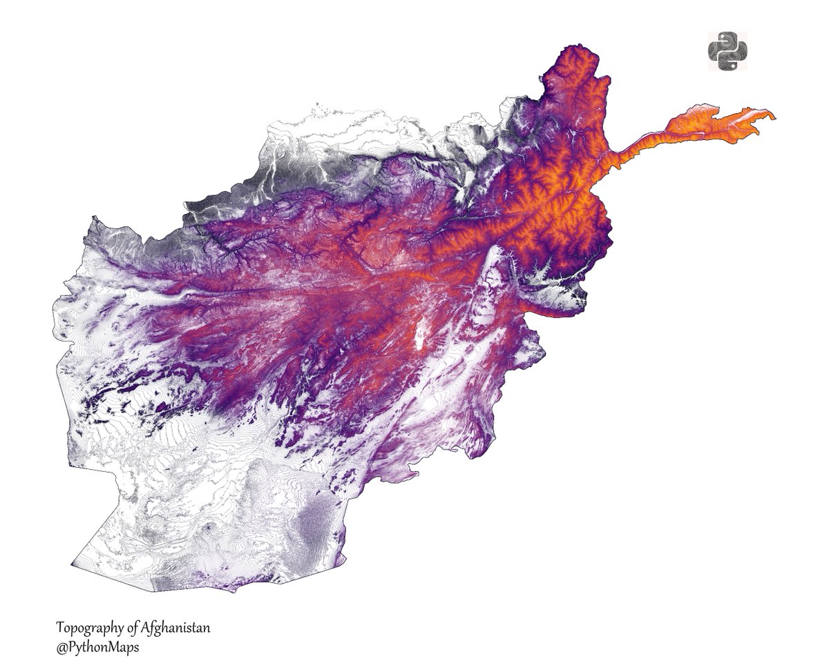
Explore Afghanistan topography like never before with this Python-made contour map. From mountains to deserts, it showcases the country's diverse landscapes. #Afghanistan #Topography #ContourMap #Python

Contour line map showing the topography of Turkey. I can't decide which colourmap I prefer. Inferno (Top) or gist_earth (Bottom) - What do you think?
Comment and let me know which country I should make next! #DataScience #Datavisualization #Geography #Turkey #Matplotlib


@Mahsa_se_nft @MatMiller_art @samjisk WIP
“The Land”
By adding the law of color to the abstracted topography, a landscape that evokes a variety of emotions.
@Korchuchin @_Koi_art @harentachibana

@morteza_yousefy WIP
“The Land”
By adding the law of color to the abstracted topography, a landscape that evokes a variety of emotions.
#generative #NFTjapan #creativecoding #NFTCommunity

WIP
“The Land”
By adding the law of color to the abstracted topography, a landscape that evokes a variety of emotions.
#generative #NFTjapan #creativecoding #NFTCommunity

@gozde_ekz WIP
“The Land”
By adding the law of color to the abstracted topography, a landscape that evokes a variety of emotions.
#generative #NFTjapan #creativecoding #NFTCommunity

@ArtWiseman WIP
“The Land”
By adding the law of color to the abstracted topography, a landscape that evokes a variety of emotions.
#generative #NFTjapan #creativecoding #NFTCommunity

Contour line map showing the topography of India, Pakistan Bangladesh, Nepal, Bhutan and Myanmar.
Comment and let me know which country I should make next! #DataScience #Datavisualization #Geography #India #Pakistan


#OldEnglish #WOTD: feþer, f.n: feather; quill, pen. (FEH-ther / ˈfɛ-θɛr) Image: Stork in Gerald of Wales’s Topography of Ireland; N England (Lincoln?), c. 1196-c.1223; @BLMedieval Royal 13 B VIII, f. 9v.

Contour line map showing the topography of Ecuador.
This map was made with #Python. Comment and let me know which country I should make next! #Data #DataScience #Datavisualization #DataScientist #Ecuador #Geography

Contour line map showing the topography of Greece.
This map was made with #Python. I converted a DEM to contour lines and then used a fun colourmap. #Data #DataScience #Datavisualization #DataScientist #Greece #Geography


We are finally selling prints of our maps! Initially we are offering our spectacular river maps and a really pretty topography plot of the UK. This is a trial run and we only have 40 of each so get yours before we (hopefully) sell out. https://t.co/isjyrXDF9K


DLWN-022 ALIAS "SNAKEMAN"
"A ROBOT MASTER DESIGNED FOR SURVEYING TOPOGRAPHY AND EXPLORING NARROW AREAS. LIGHTWEIGHT AND SLIM. MORE DETAILS BELOW..."


@Peruredi_ I wanna make a topography mapping of that body with my tongue 👀💦💦💦

Day 2 of the #30DayMapChallenge - Lines.
Contour line map showing the topography of Great Britain.
This map was made with #Python using #Numpy, #matplotlib and #earthpy. #data #DataScience #data #dataviz #DataScientist #uk #gb #eu #geography