ArcGISのTwitterイラスト検索結果。 23 件


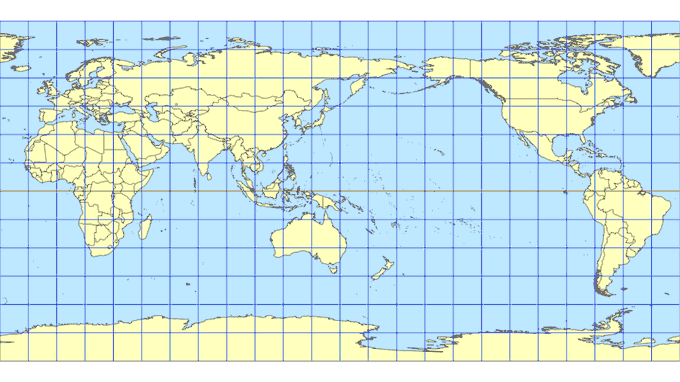


#ArcGISPro はver3.0でも #舟形多円錐図法 はサポートされていません。しかし、マップのプロパティにあるクリップ機能を使えば、ひとつのデータで12個の #多円錐図法 を並べたレイアウトが作成できます。
舟形多円錐図法はミカンの皮をむくイメージに近い図法です。
#地図投影法 #一日一図法


全世界の人口密度グリッドデータ。
https://t.co/GNOVOtVSxi
例えばヨーロッパに注目すると「青いバナナ」がはっきり分かります。上記のArcGIS Webマップは教育利用限定のコンテンツですが、公開元サイトではCC BY 4.0のTIFFファイルなども入手できます。
https://t.co/mZdITCxoiL


May's Procrastination Map is one of the largest outflow channel systems on Mars, Kasei Valles. This giant system of canyons is ~1580km long, possible formed by multiple flooding events. I used 250m contours.
🛰️#Mars #MarsGeology #MarsMapping #Geology #MOLA #ArcGIS #ESRI #phdlife


Geologic Map of Taiwan - Geologic Survey of Taiwan - 1953
3D render
#geology #geography #cartography #GIS #b3d #arcgispro

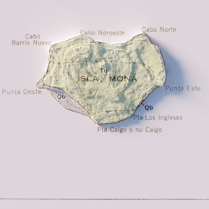

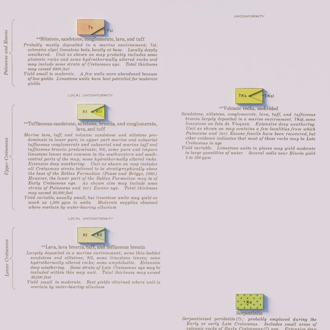
Hydrogeologic Map of Puerto Rico and Adjacent Islands - USGS - 1965
#arcgispro #b3d #PuertoRico #geology #geography #GIS #dataviz #cartography


South America - 1922 - John Bartholomew and Son - "The Times" Atlas
#arcgispro #b3d #SouthAmerica #GIS #dataviz


地図で見る2020年国勢調査 人口速報集計!総務省統計局より本日公開された国勢調査の速報集計を可視化してみました。
前回調査(平成27年度)に比べ約86万人が減少し、38道府県で人口が減っていることがわかります。#国勢調査#人口速報集計#e-Stat#ArcGISOnline https://t.co/zxI4JgmCUo


Geological Map of the British Islands - Based on the work of the Geological Survey - Ordnance Survey - 1939
#arcgispro #b3d #BritishIsles #Ireland #Wales #UK #Scotland #England #geology #geography #GIS


A redditor requested Italy in the same circle style. So here you go. Each circle is approx 707km².
#arcgispro #b3d #Italy #Italia #3dart


Maps and the park: how to use OS OpenData with
@Esri's ArcGIS Pro, and create your own map and print it on to canvas...........https://t.co/ZJMLcgcUcZ #maps (Image: OS Data)


Bedrock Geologic Map of Indiana - 1987 - State of Indiana Department of Natural Resources
#arcgispro #b3d #geology #geography #GIS #dataviz


Experimenting with #ArcGISPro and #AdobePhotoshop to simulate a hand-drawn, manually-airbrushed shaded relief of #Amorgos island in #Cyclades #Greece. Sole input data the dem of the island.
#cARTography #MakingMapsPretty


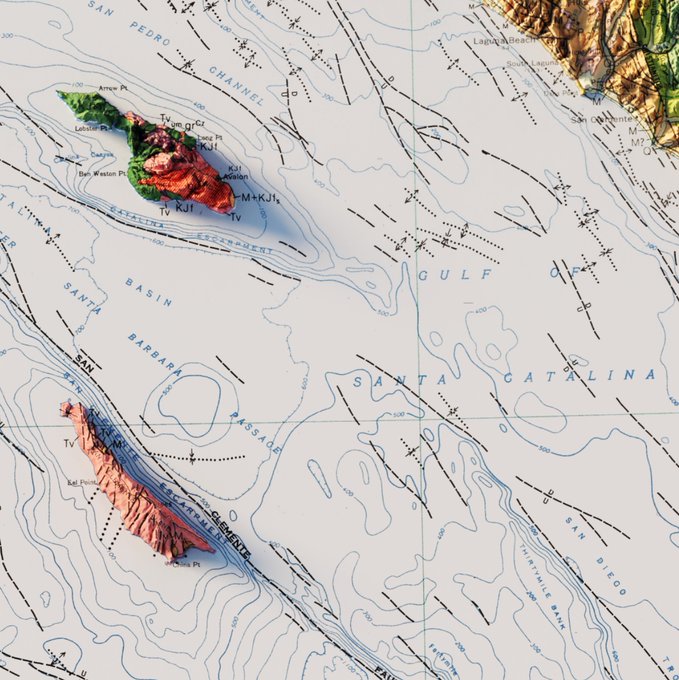

Geologic Map of California - 1977
#arcgispro #b3d #California #geology #geography #gis #dataviz

Dymaxion projection render, take 2. Reduced exaggeration and tried to make it so you could actually see the sea floor.
@Esri calls it the Fuller (World) projection, but Dymaxion sounds cooler.
#arcgispro #ArcGIS #b3d


Just found an old HDD at the bottom of a box in the garage. Didn't know where it came from.
Turns out it has my entire BSc dissertation on it, including all the raw GIS data and ArcGIS files from 8 years ago!
Glad to see I chose to store everything in "New File Geodatabase.gdb"


R. Ufficio Geologico - Carta geologica delle Alpi occidentali - Dedotta Dai Rilevamenti Eseguiti Gagli Ingegneri del R. Corpo Delle Miniere, dal 188 al 1906 - Roma, 1908
#arcgispro #blender #maps #gis #dataviz #geological #cartography #copernicus #geospatial #3dart #3dmodeling

Coronavirus and the park: responsible and ethical mapping considerations.......from the ESRi Arcgis blog.........https://t.co/xsWhvb7bHr (Image: the author)

2018年における日本の輸出相手国上位10カ国とその輸出金額を示す流線図を作成しました。
「ArcGIS Pro による流線図の作成(その2)」 https://t.co/OzFckW6jwM


Esri Australia is hiring a Senior Consultant in support for ArcGIS Enterprise! Want to know more?
Email ttorche@esriaustralia.com.au or click here: https://t.co/uTP4cXJg6p