datascientistのTwitterイラスト検索結果。 68 件中 3ページ目

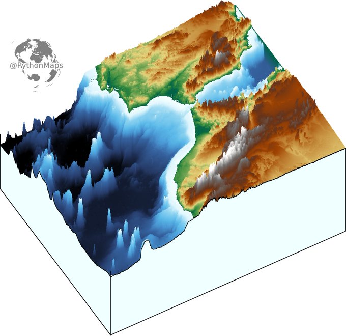
3D digital elevation model of the strait of Gibraltar for day 11 of the #30DayMapChallenge .
This map was made with #Python using #Numpy, #matplotlib and #earthpy. #data #DataScience #data #dataviz #DataScientist #eu #geography #artwork #art #Gibraltar #Brexit


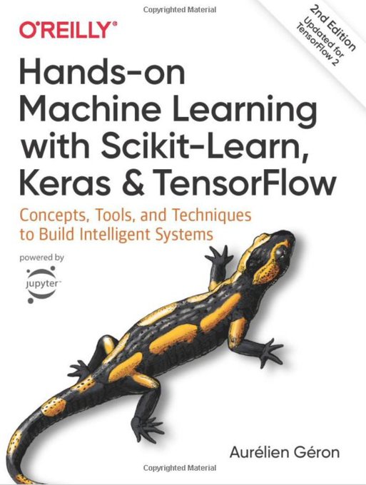
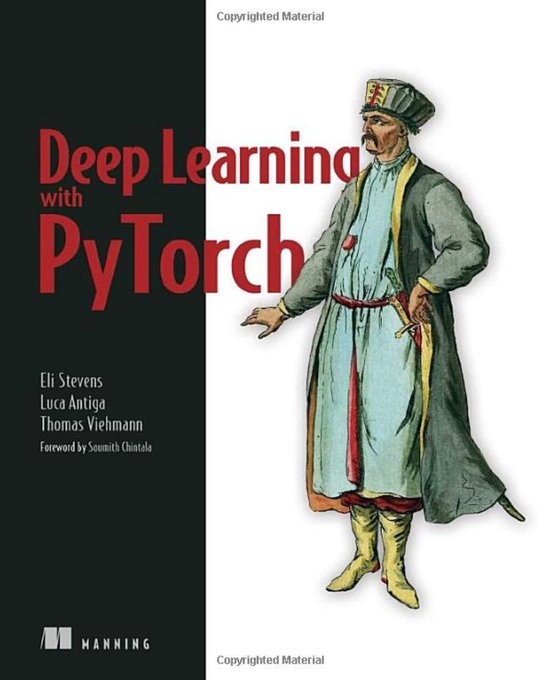
Top #DeepLearning #Books for 2021
https://t.co/1gEpvq90xN
v/ @gp_pulipaka
#DataScience #BigData #Analytics #AI #MachineLearning #ML #IoT #IIoT #IoTPL #CloudComputing #CyberSecurity #Serverless #RPA #NLP #Coding #Programming #100DaysofCode #CodeNewbie #DataScientist #DEVCommunity https://t.co/qax73Dt1eh
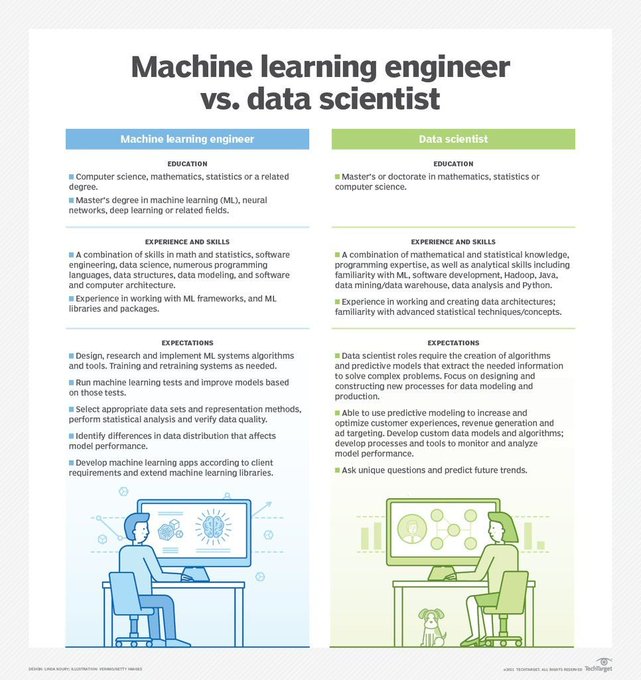


#DataScientists 🆚 #MachineLearning #Engineers 👨🏽💻
https://t.co/0pg1Xd9vbO
v/ @gp_pulipaka
#DataScience #BigData #Analytics #AI #ML #IoT #IIoT #IoTPL #Python #RStats #CloudComputing #Serverless #RPA #NLP #Coding #Programming #100DaysofCode #CodeNewbie #DEVCommunity #WomenWhoCode https://t.co/o8Yw3gyxEy

Topography map of the greatest country in the world... Ireland. Colours correspond to the national flag obviously.
This map was made with #Python using #Numpy, #matplotlib and #Pandas. #data #DataScience #data #dataviz #DataScientist #Ireland #eu #geography #artwork #art

Contour line map showing the topography of Great Britain. Zoom in!
This map was made with #Python using #Numpy, #matplotlib and #earthpy. #data #DataScience #data #dataviz #DataScientist #uk #gb #eu #geography #artwork #art


Top 7 Must Have #Books for #DeepLearning
https://t.co/f0XB9jqi7E
v/ @gp_pulipaka
#BigData #Analytics #DataScience #AI #MachineLearning #ML #IoT #IIoT #IoTPL #Python #CloudComputing #Serverless #RPA #NLP #DataScientist #Programming #Coding #100DaysofCode #DevCommunity #CodeNewbie https://t.co/gEM4Aovwac


The 3 Must-Read #DataScience #Books for Absolute New Learners. #BigData #Analytics #AI #MachineLearning #IoT #IIoT #Python #RStats #TensorFlow #JavaScript #ReactJS #CloudComputing #Serverless #DataScientist #Linux #Programming #Coding #100DaysofCode
https://t.co/5jBeAvQsX2


Python Books for Engineers 2021. #BigData #Analytics #DataScience #IoT #IIoT #PyTorch #Python #RStats #TensorFlow #Java #JavaScript #ReactJS #GoLang #CloudComputing #Serverless #DataScientist #Linux #Books #Programming #Coding #100DaysofCode
https://t.co/Kup1ihxTP8


Data analysis.
(Throwback cartoon)
Follow for more cartoons!
#Data #dataviz #DataScience #DataAnalytics #DataScientist #DataMining #whatpeoplelike #comics #comicstrip #webcomic #webcomics #cartoon


#DataScientists 🆚 #MachineLearning Engineers
https://t.co/0pg1Xd9vbO
v/ @gp_pulipaka
#BigData #Analytics #DataScience #AI #ML #DL #IoT #IIoT #IoTPL #CloudComputing #CyberSecurity #Serverless #RPA #NLP #DataScientist #Programming #Coding #100DaysofCode #CodeNewbie #DEVCommunity https://t.co/o8Yw3gyxEy


Math and Architectures of Deep Learning. #BigData #Analytics #DataScience #AI #MachineLearning #IoT #IIoT #Python #RStats #JavaScript #ReactJS #GoLang #CloudComputing #Serverless #DataScientist #Linux #Books #Mathematics #Programming #Coding #100DaysofCode
https://t.co/XoaM7kqUF1


CNN using Feature Extraction and PyTorch. #BigData #Analytics #DataScience #AI #MachineLearning #IoT #IIoT #Python #RStats #TensorFlow #Java #JavaScript #ReactJS #GoLang #CloudComputing #Serverless #DataScientist #Linux #Programming #Coding #100DaysofCode
https://t.co/OzSps85uun


Not every problem or part of it must be solved by accepting that brute force is the only option, despite our current computing capabilities, this acceptance is a long-term limit but, above all, a barrier to our own #creativity.
#datascience #BigData #ML #AI #data #datascientist


Free Data Science Books. #BigData #Analytics #DataScience #AI #MachineLearning #IoT #IIoT #PyTorch #Python #RStats #TensorFlow #Java #JavaScript #ReactJS #GoLang #CloudComputing #Serverless #DataScientist #Linux #Books #Programming #Coding #100DaysofCode
https://t.co/DgkS3cAOQ3 https://t.co/Ub4FCLbQJX


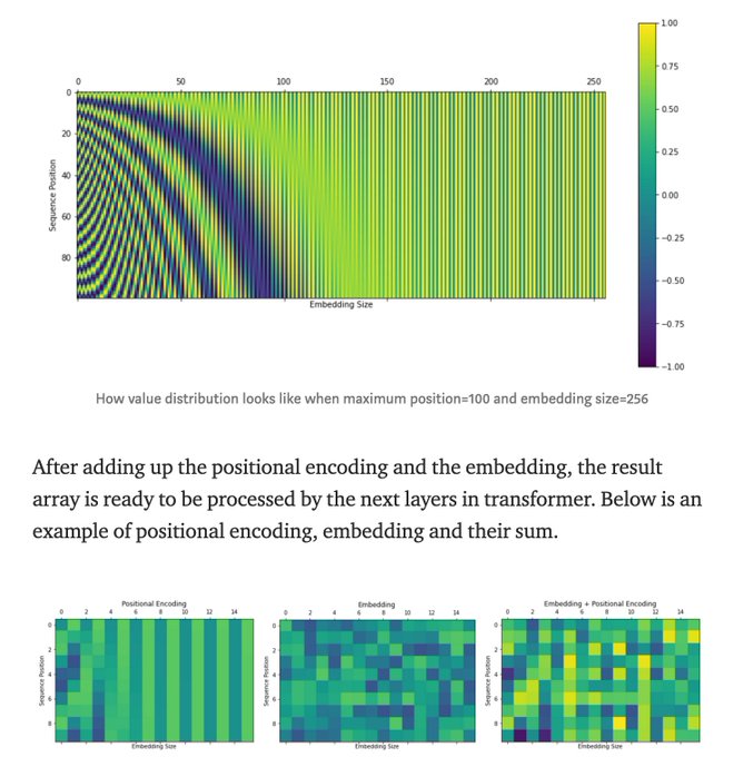

What Exactly is Happening Inside the Transformer. #BigData #Analytics #DataScience #AI #MachineLearning #NLProc #IoT #IIoT #PyTorch #Python #RStats #JavaScript #ReactJS #CloudComputing #Serverless #DataScientist #Linux #Programming #Coding #100DaysofCode
https://t.co/0ix5HE4A4g


11 Best #Python Programming Books for Beginner (2020 Update). #BigData #Analytics #DataScience #IoT #IIoT #PyTorch #RStats #TensorFlow #Java #JavaScript #ReactJS #CloudComputing #Serverless #DataScientist #Linux #Books #Mathematics #Programming #Coding
https://t.co/kfKV7wE3R9